


There are many places around the world that are classified. These places are either blurred or have been pixilated by the Google Earth. There is no known reason behind this but these places are only known because of the surrounding information available. Some of these places are either government buildings, mountains, houses of people. Nobody else but only Google knows what it is hiding behind those blurry images. Here are the 15 secretive places that Google never wanted us to see.
1. Moruroa, French Polynesia
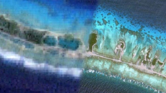
Moruroa, an atoll situated in the islands of French Polynesia, South Pacific. When it is seen from the Google Earth, it looks like as if they have something to hide. Many islands are clearly visible including many parts of atoll but many places are blurred. An airstrip, few buildings, and dock are clearly visible. It is known that the vicinities of Muroroa atoll were nuclear testing sites around 1966 to 1996 for the French. This may be the reason for the blurring.
2.Taipei, Taiwan
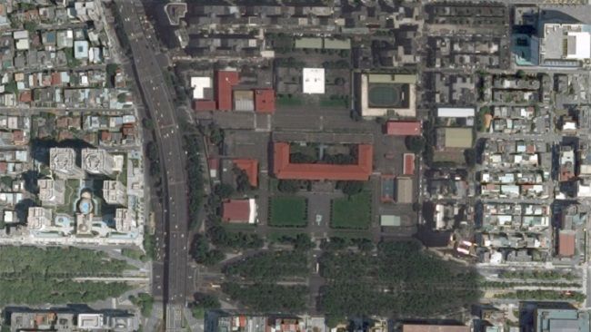
When you see at first, it will come across as very normal air facility in the Taipei area, Republic of China. But, if you look closely you will see that the whole area is having a different shade compared to the surroundings.
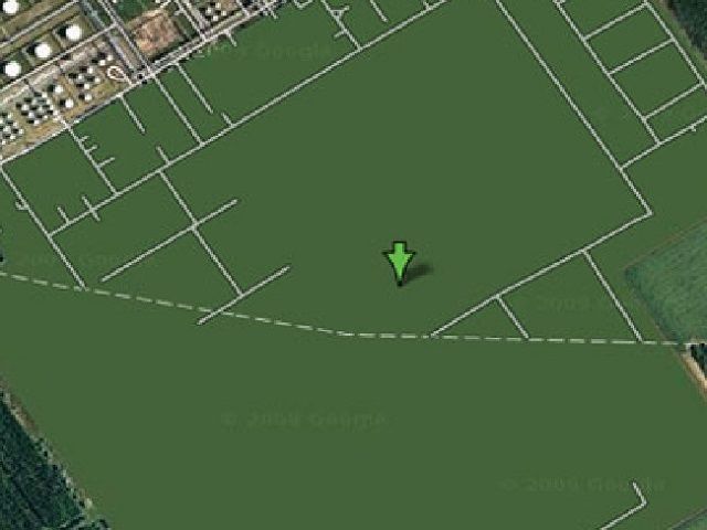
3.Utrecht, Netherlands
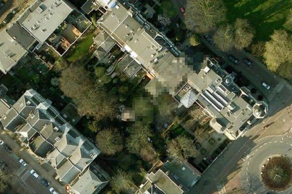
This house is completely blurred by Google Earth and nobody is aware why this has been done. The house is located at 8 Oorsprongpark, Utrecht which is in Holland. The roof is completely blurred and can be noticed clearly as compared to the houses in the surroundings.
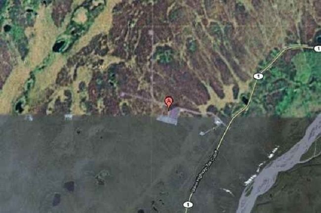
4. Junction Ranch, California
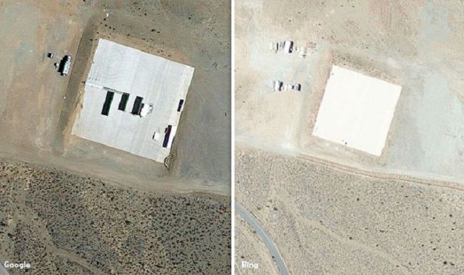
Junction Ranch, a site for military testing with a big airstrip. It’s a part of the facilities at the station of the Naval weapon situated at the China Lake. It is said that the Government is carrying out a project on the drones there. That may be the reason why that area, in particular, has been scratched out.
5. Snow Saddle, Nepal

Kantega or also known as the Snow Saddle is located at a height of 22,000 feet in Himalayas, Nepal. Bing maps show this area in particular as pixilated while Google maps blacked it out. It is believed that Nazis made some secret explorations here an discovered a UFO base and their testing site. This area is famous for UFO sightings at large and maybe that is why this area has been blacked out so as to discourage its secret entrance to be discovered by the world.
6. Chukotka Autonomous Okrug, Siberia
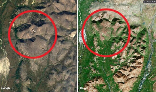
Chukotka, located in the Russian Federal region has an area which belongs to the wilderness and it has been totally blurred out by the Google maps. A fake satellite image has been rather pasted over that region to make people think that is normal. This area is allegedly known to be a HAARP Russian site which is actually a facility for testing of ICBM or it may be a gold mine.
7. Sandy Island
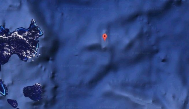
Sandy Island which is located in the Coral Sea off the Australian coast is Captain Cook’s discovery. It used to always feature in the maps in the 1800 but disappeared suddenly. Google maps blacked out this island earlier with a black box but Bing completely removed it. A research ship tried to locate it with the coordinates available from earlier times but failed badly. What did Cook find? Is there really an island there which is kept as a secret or it disappeared. Nobody knows.
8. Broken Arrow, Greenland
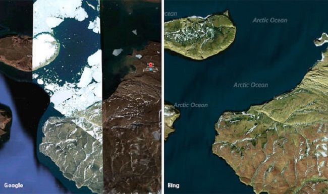
The term broken arrow means damaged or a fallen nuclear weapon and is widely used by the military of the US. It’s also a site located in Greenland which is highly pixilated by the Google maps. In 1960-1968, the air force of the US carried out a secret and highly classified operation. It was during the Cold war and that mission was called “The Chrome Dome”. This operation involved some accidents of B-52 bombers which had thermonuclear weapons. The accident led to the end of that program in the year 1968. It is presumed by many that those accidents lead to the poisoning of much military personnel by radiations but no reason behind pixilating is known as such till now.
9. Baker Lake, Nunavut, Canada
There is a plot in the Baker Lake area of Canada which has been blackened out by the Google maps. Many theorists feel that it is hiding extraterrestrials which the government doesn’t want anyone to see.
10. Szazhalombatta Oil Refinery, Hungary
The reason is highly unknown why this oil refinery in Hungary was marked as green with all its surrounding areas completely deleted including buildings and its surroundings. It is a rumor that the green patch hides a green field but maybe there is something worth hiding beneath that grass.
11. Keowee Dam, USA
This water reservoir situated in South Carolina has a shape of Christmas tree and can be seen as a completely blurry patch on the Google maps. Many believe that is, in fact, an Oconee Nuclear station which is also called American Fukushima.
12. Unknown Area In Siberian Tundra, Russia
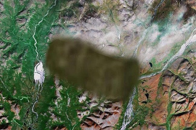
Compared to all the secretive places on the Google maps this is one of the most mysterious ones. This place is situated in the Tundra region near the border of Alaska. The Russian authorities carried out sealing many cities and small towns during 1986 which were homes to a million of people. These cities were given very mysterious names like Tomsk-7 and Krasnoyarsk-26 or Arzamas-16. Arzamas-16 was the colony comprising of the nuclear scientists and engineers. It is believed by many that this was taken up by the government and was used as the radar and missile station during the cold war.
13. The Michael AAF Building, USA
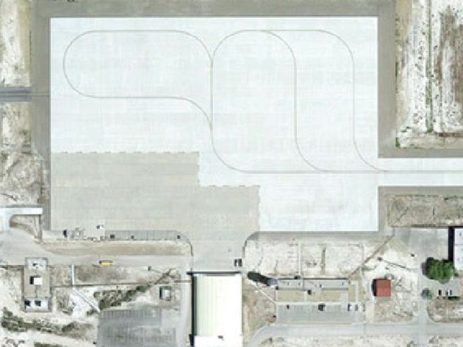
This place in Utah belongs to the US army and is known to be a classified one. The only information available about this place is that it is being used as the chemical as well as biological weapons testing center. The whole area has been blacked out by the Google maps.
14. HAARP Site, Gakona, Alaska, USA
HAARP is an abbreviation for High-Frequency Active Aural Research Program. It is the most controversial operations which are being carried out by the USA. The AK site at Gakona conducts ionospheric tests and theorists believes that it is responsible for natural disasters like earthquakes but no such evidence has been found out till now. Many observers have even noted that the surroundings are copied and pasted from other countries.
15. Valencia City, Philippines
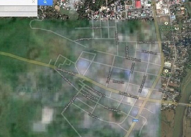
Valencia City is located in the Philippines and is home to around 160,000 people. But, this is also known as the headquarters of the missile testing and various other defence programs of the government. Maybe this is a reason why this place is pixilated due to the security concerns.